

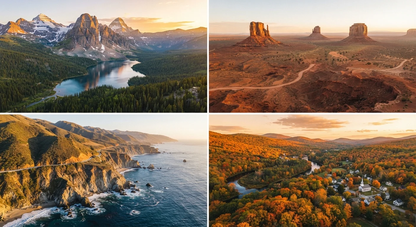
How to Use This Regional Season Guide
The United States spans six time zones, two mountain ranges, multiple climate bands, and terrain ranging from tropical to subarctic — which means "travel season" means something very different depending on where you're headed. This guide breaks the country into four broad regions and maps each against the four seasons, so you can match your destination to your calendar rather than guess.
Keep in mind that weather patterns vary by year, elevation, and microclimate. Always verify current conditions and any entry requirements — including national park reservations or coastal storm advisories — through official sources before you go. For a deeper look at how crowd cycles and permit systems work at federal lands, see our guide to national park visits for first-timers.
| US Climate Zones | At least 9 distinct climate types (tropical to subarctic) (NOAA Climate Classification) |
| Hurricane Season (Atlantic/Gulf) | June 1 – November 30 (National Hurricane Center) |
| Peak Fall Foliage (Northeast) | Mid-October (New England) to early November (Mid-Atlantic) (US Forest Service) |
| Desert Southwest Peak Season | March–May and September–November (General climatic consensus) |
| Ski Season (Mountain West) | Approximately December–March (Varies by elevation and resort) |
| Pacific Coast Rainy Season | October–April (Oregon, Washington) (NOAA precipitation data) |
The Northeast & Mid-Atlantic
This region runs from Maine's rocky coast down through New York, Pennsylvania, and Washington D.C. Summers (June–August) bring warm, humid weather and peak tourism — expect full hotels in coastal areas and long lines at major city museums. Fall (September–November) is widely considered the region's signature season: foliage peaks from mid-October in northern New England to early November in the mid-Atlantic, drawing crowds but rewarding visitors with genuinely spectacular color. Comparing New England's shoreline to the Gulf Coast can help you decide which coastal character suits your trip best.
Winters are cold and snowy, particularly inland and in New England, but cities like New York and Philadelphia remain fully operational and considerably less crowded. Spring (April–May) offers mild temperatures and blooming landscapes — a genuinely underrated window before summer prices kick in.
Shoulder Season
The period between a destination's peak and off-peak seasons. Shoulder season often offers a balance of manageable crowds, moderate weather, and more accessible accommodations — typically spring and fall for most US regions.
Peak Season
The time of year when a destination sees its highest visitor volume. For most US regions this is summer, though it shifts to winter in warm-weather destinations like Florida and Arizona.
Hurricane Season
The Atlantic hurricane season officially runs June 1 through November 30, with peak storm activity typically in August and September. Coastal southeastern US destinations are most affected.
Microclimate
A localized climate zone that differs from the broader regional pattern due to elevation, proximity to water, or terrain. San Francisco's fog versus inland Bay Area heat is a classic US example.
The South & Gulf Coast
Spanning Florida, the Gulf Coast, and inland states like Tennessee and Georgia, the South operates on a nearly inverted season calendar from the Northeast. Winter (December–February) is the most comfortable time to visit Florida and the Gulf — mild temperatures, lower humidity, and reduced hurricane risk make this a prime window. Summer heat in this region is intense and humidity is high; cities like New Orleans and Atlanta can feel punishing in July and August, though events and culture don't slow down.
Hurricane season runs officially from June 1 through November 30, with peak activity in August and September — particularly relevant for coastal Florida, the Gulf, and the Carolinas. Always monitor NOAA advisories if you're traveling during that window. Lesser-known Southern cities like Savannah, Georgia or Natchez, Mississippi often offer the full regional experience with fewer crowds year-round.
110°F+
Average summer high in Phoenix, AZ
Death Valley and the broader Sonoran Desert regularly exceed this threshold in July and August, presenting real heat safety risks for visitors.
~14
US states affected by tornado risk in spring
NOAA estimates peak tornado activity across the Great Plains and Midwest between April and June each year.
3 billion+
Annual visits to US national parks and federal lands
According to the National Park Service, visitation has grown significantly over the past decade, making seasonal timing more important than ever.
The West: Mountain, Desert & Pacific Coast
The American West is vast enough to hold every season simultaneously. The Pacific Coast (California, Oregon, Washington) enjoys mild, dry summers and rainy winters — coastal destinations like Big Sur and Olympic National Park are accessible year-round but require rain gear from October through April. The mountain West (Colorado, Montana, Wyoming) splits into two distinct seasons: summer hiking season peaks July–September, while ski season runs roughly December–March.
Desert Southwest (Arizona, Utah, Nevada) follows a different logic entirely: spring (March–May) and fall (September–November) are the sweet spots, with moderate temperatures ideal for canyon hiking. Summer temperatures in places like Phoenix and Death Valley routinely exceed 110°F — heat that poses genuine safety risks. Plan desert trips outside of peak summer, and always carry more water than you expect to need. For those connecting these destinations by road, our US road trip planning guide covers realistic route pacing across the region.
Elevation Changes Everything in the West
A destination listed as "warm in summer" in a western state might sit at 8,000 feet elevation, where afternoon thunderstorms and cold nights are common even in July. Always check the specific elevation of your destination — not just the state or region — when packing and planning activities. Weather.gov provides elevation-adjusted forecasts for mountain locations.
The Midwest & Great Plains
Often overlooked in national travel conversations, the Midwest delivers genuine seasonal diversity and far fewer crowds than coastal destinations. Spring and fall are the most pleasant windows for cities like Chicago, Minneapolis, and Kansas City — mild temperatures, cultural events, and hotel availability that's forgiving on budgets. Chicago's summers are lively and vibrant; winters are brutally cold, though the city doesn't lose its energy.
The Great Plains states (Nebraska, Kansas, the Dakotas) are most rewarding in late spring through early fall, particularly for road trippers attracted to open landscapes, state parks, and Native American heritage sites. Tornado season (roughly April–June) is a real weather consideration across portions of this region — keeping a weather app active and flexible itinerary is practical, not paranoid. Common misconceptions about US city travel apply in Midwestern metros just as much as the coasts — walkability and neighborhood character vary significantly.
The content provided on our blog site traverses numerous categories, offering readers valuable and practical information. Readers can use the editorial team’s research and data to gain more insights into their topics of interest. However, they are requested not to treat the articles as conclusive. The website team cannot be held responsible for differences in data or inaccuracies found across other platforms. Please also note that the site might also miss out on various schemes and offers available that the readers may find more beneficial than the ones we cover.