

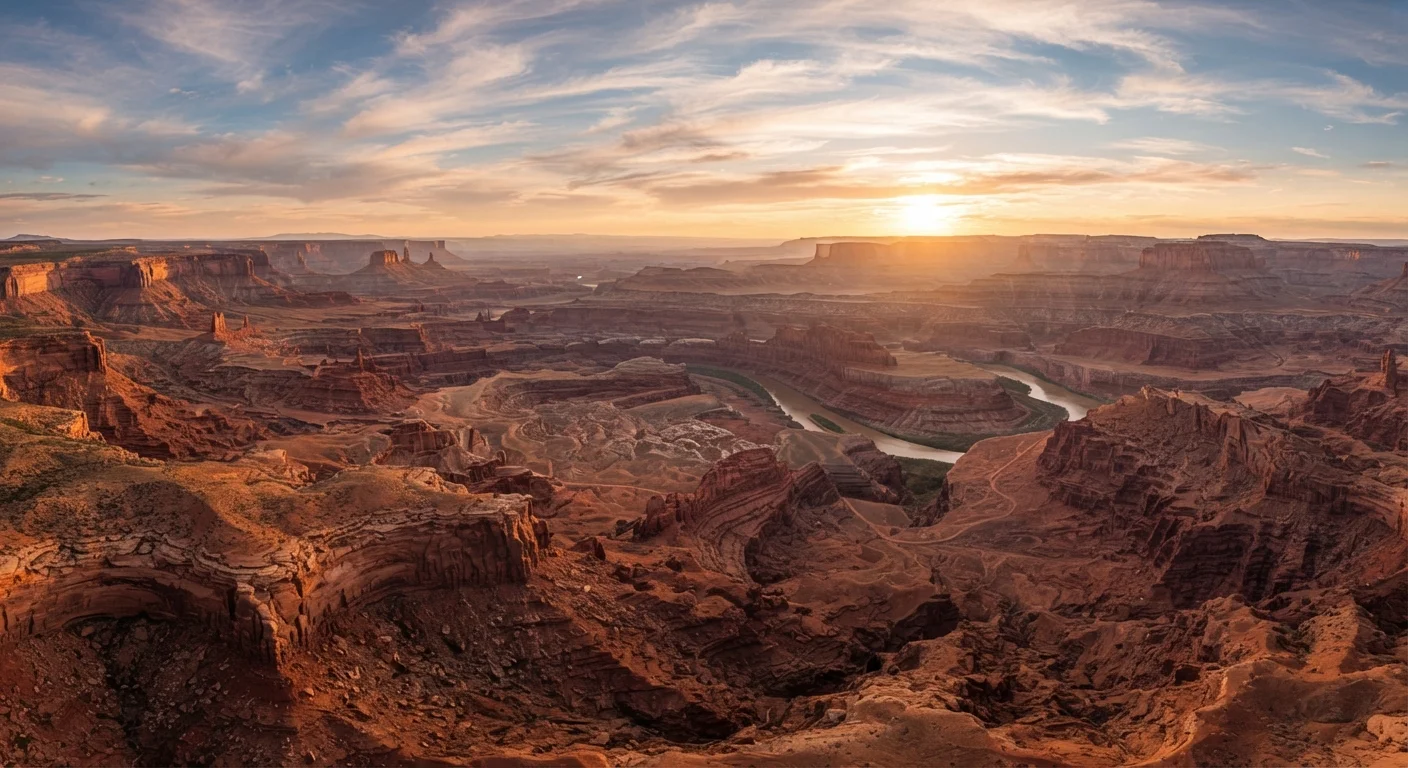
A Landscape Built in Layers
If you've ever stared at a canyon wall and felt like you were reading a book, you weren't far off. Every horizontal stripe of red, cream, purple, or gray sandstone in the Southwest represents a distinct chapter of Earth's history — ancient dunes, inland seas, tidal flats, and river deltas that existed long before humans walked the continent.
The process began when sediment accumulated in thick deposits over hundreds of millions of years. Weight compressed those deposits into rock. Then, roughly 65 to 70 million years ago, tectonic forces began pushing the Colorado Plateau upward — a massive geological event called the Laramide Orogeny. That uplift is the reason canyon walls now stand thousands of feet above sea level, and the reason rivers like the Colorado had enough gradient to carve deeply downward rather than meandering flat.
277 miles
Length of the Grand Canyon
The Grand Canyon stretches 277 river miles and reaches depths of over a mile, according to the National Park Service.
130,000 sq mi
Area of the Colorado Plateau
The Colorado Plateau spans approximately 130,000 square miles across four U.S. states, forming the geological heart of Southwest canyon country.
2,000+
Documented arches in one Utah park
Arches National Park in Utah contains over 2,000 catalogued sandstone arches, the highest known concentration anywhere on Earth.
What Makes the Rock Red
The Southwest's signature palette — burnt sienna, terracotta, rust orange — has a surprisingly simple explanation: iron. Ancient sandstones contain iron minerals that, when exposed to oxygen over geological time, oxidized in much the same way a nail left in the rain turns red with rust.
Not all Southwest rock is red, though, and those variations tell their own story. Pale cream or white layers typically indicate environments where iron was leached away or never present — often ancient desert dunes preserved as Navajo Sandstone. Darker, purplish bands in formations like the Chinle often reflect volcanic ash deposits from eruptions millions of miles and years removed. The colors aren't decoration; they're data.
Flash Floods Are a Real and Active Force
The same erosion processes that carved the Southwest's canyons over millions of years can also occur suddenly and violently. Flash floods — triggered by rain falling miles away — can fill a narrow canyon in minutes with little warning. Always check weather conditions and heed any official advisories before entering slot canyons or canyon bottoms. Verify current conditions with the relevant national park or land management agency before your visit.
How Canyons, Arches, and Hoodoos Form
Water and wind are the Southwest's great sculptors, but they work in distinct ways. Canyon systems like the Grand Canyon or Bryce Canyon form primarily through fluvial erosion — rivers cutting steadily downward through rock over millions of years. The Colorado River, for example, has been carving the Grand Canyon for roughly five to six million years, exposing rock layers nearly two billion years old at its deepest point.
Arches form through a different mechanism. Water infiltrates cracks in sandstone, freezes, expands, and chips away fragments in a process called freeze-thaw weathering. Over thousands of repetitions, a rock fin thins until only a graceful arch remains. Arches National Park in Utah contains more than 2,000 documented arches — the highest concentration on Earth.
Hoodoos — those narrow, cap-topped spires iconic to Bryce Canyon — form when a harder rock cap protects the softer stone beneath it from rain erosion, while surrounding material washes away. The result is a surreal forest of towering spires in shades of pink and orange.
Look for the Geological Story on Any Trail
Park visitor centers throughout the Southwest typically display rock layer diagrams that match what you'll see on the trail. Picking one up before you hike gives you a practical key to reading the landscape as you go. Many rangers also lead geology-focused walks — worth checking the schedule when you arrive.
What This Means for Travelers
Understanding the geology doesn't just make you a more interesting hiking companion — it transforms how you experience the landscape. Recognizing that a canyon wall is a timeline, that an arch is erosion mid-process, and that a flash flood warning isn't to be taken lightly (those same floods that built the canyons are still actively reshaping them) makes the Southwest far more vivid and meaningful.
For trip planning, geology also informs practical decisions. Some formations are more fragile than they appear — cryptobiotic soil crusts, those dark crusted patches on desert floors, can take decades to recover from a single footstep. Staying on designated trails protects both the landscape and future visitors.
Whether you're planning a classic national park circuit or hunting for lesser-known canyon country, the Southwest rewards curiosity. See our guide to visiting national parks before you go, and consider planning your road trip route with the geology in mind — the best viewpoints often reward a little detour.
Frequently Asked Questions
The red and orange hues come from iron oxide — essentially rust — coating grains of sandstone. When ancient desert sediments were exposed to oxygen over millions of years, iron minerals oxidized, staining the rock its signature warm color.
The Grand Canyon's walls expose nearly two billion years of Earth's history. Ancient seas, river deltas, dunes, and swamps each deposited sediment that compacted into distinct rock layers. The Colorado River then slowly eroded downward through those layers over millions of years.
Arches form when water seeps into cracks in sandstone, freezes, expands, and breaks off chunks over thousands of cycles. Wind carries away loose particles, and over time a thin fin of rock is hollowed out into a freestanding arch.
The Colorado Plateau is a high, relatively flat geological region covering about 130,000 square miles across Utah, Arizona, Colorado, and New Mexico. It was pushed upward by tectonic forces, and rivers then cut through its thick sedimentary layers to create the canyon landscapes the Southwest is famous for.
Yes — erosion continues constantly, though slowly by human timescales. Arches collapse, canyon walls slough off, and rivers keep carving. Flash floods, in particular, can reshape canyon floors dramatically in a single storm event.
The content provided on our blog site traverses numerous categories, offering readers valuable and practical information. Readers can use the editorial team’s research and data to gain more insights into their topics of interest. However, they are requested not to treat the articles as conclusive. The website team cannot be held responsible for differences in data or inaccuracies found across other platforms. Please also note that the site might also miss out on various schemes and offers available that the readers may find more beneficial than the ones we cover.